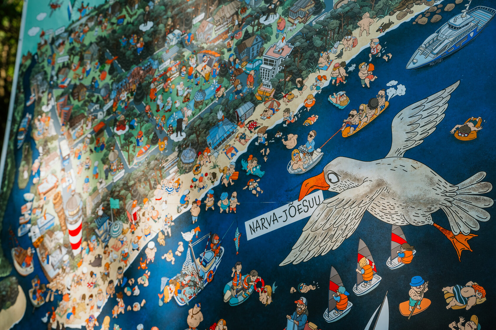
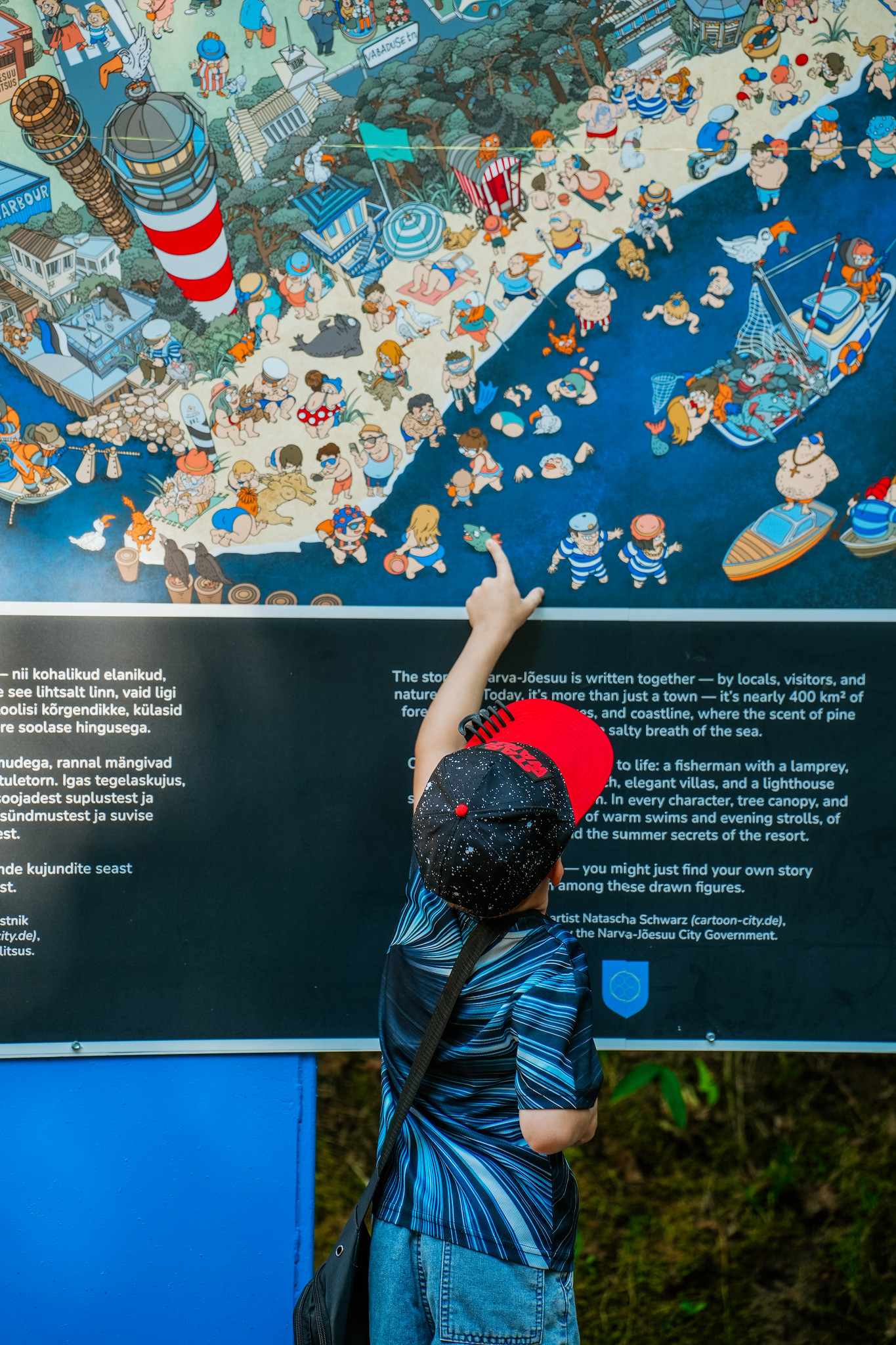
Narva-Jõesuu now has a distinctive illustrated map — a hand-drawn poster that presents the town not merely as streets and landmarks, but as a living environment with character and atmosphere. Rather than a conventional navigation map, it is a visual narrative in which architecture, nature and everyday scenes come together.
This is a map meant to be explored visually, inviting viewers to linger, recognise familiar places and discover new details.
The project was commissioned by the City of Narva-Jõesuu as part of a broader approach to enhancing public space and visual identity.
This is a map meant to be explored visually, inviting viewers to linger, recognise familiar places and discover new details.
The project was commissioned by the City of Narva-Jõesuu as part of a broader approach to enhancing public space and visual identity.
Author and artistic approach
The map was created by illustrator Natasha Schwarz, founder of the studio Urban Cartoonery. Urban Cartoonery specialises in hand-drawn illustrated city maps, combining cartography, illustration and storytelling into a single cohesive composition. Each building and element is carefully integrated to reflect the rhythm and character of the place.
Research before drawing
Before starting the final illustration, the artist carried out extensive research:
This ensures that the map is not an abstract invention, but an artistic interpretation grounded in real observation.
- photographing streets, buildings and details,
- studying historical photographs,
- identifying visual elements that define the resort town.
This ensures that the map is not an abstract invention, but an artistic interpretation grounded in real observation.
The illustrated map brings together Narva-Jõesuu’s key layers — the sea and sandy beach, pine forests, the lighthouse, historic architecture and everyday resort life. Together, they form a visual story that conveys the atmosphere of the townrather than a single moment in time. The map works as an invitation to dialogue: every viewer reads it in their own way, discovering details and meanings that resonate personally.
Urban Cartoonery: cities as visual stories
The illustrated map of Narva-Jõesuu is part of Urban Cartoonery’s broader artistic concept, in which cities are treated as visual stories rather than simple geographic layouts. Each project goes beyond mapping and focuses on storytelling through details, everyday scenes and recognisable symbols.
Urban Cartoonery’s portfolio includes hand-drawn city maps and posters for Berlin, Luxembourg, Cologne, Rome and Torrevieja, among others. Every illustration is developed from the unique character and rhythm of the place, resulting in a distinct visual narrative.
Urban Cartoonery works are used in public space, city branding and souvenir design — contexts where a city can communicate its identity visually, even without words.
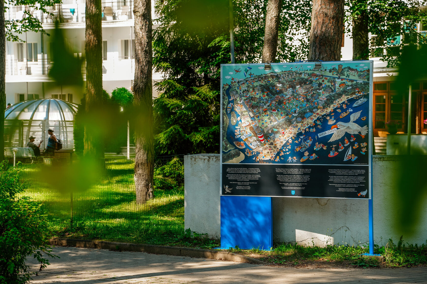
Where to see the map?
The illustrated map-poster is displayed on two outdoor information boards on Aia Street, one of Narva-Jõesuu’s most frequented promenade areas.
The illustration is also used on Narva-Jõesuu souvenir products, allowing the map to function as a lasting visual symbol of the town beyond its physical location.
The illustration is also used on Narva-Jõesuu souvenir products, allowing the map to function as a lasting visual symbol of the town beyond its physical location.
The story of Narva-Jõesuu is written collectively — by local residents, visitors, and nature itself. Today, it is more than just a town: it is nearly 400 km² of forests, historic hills, villages and coastline, where the scent of pine mingles with the salty breath of the sea.
On this map, everything comes to life: a fisherman with a lamprey, children playing on the beach, elegant villas and a lighthouse clinging to the horizon. In every character, in the tree canopies and in every building, echoes of memories can be found — of warm swims and evening walks, of meaningful moments and the summer secrets of the resort. Look closely — you may recognise your own story among these images.
The illustration was created by artist Natascha Schwarz, commissioned by the City Government of Narva-Jõesuu.